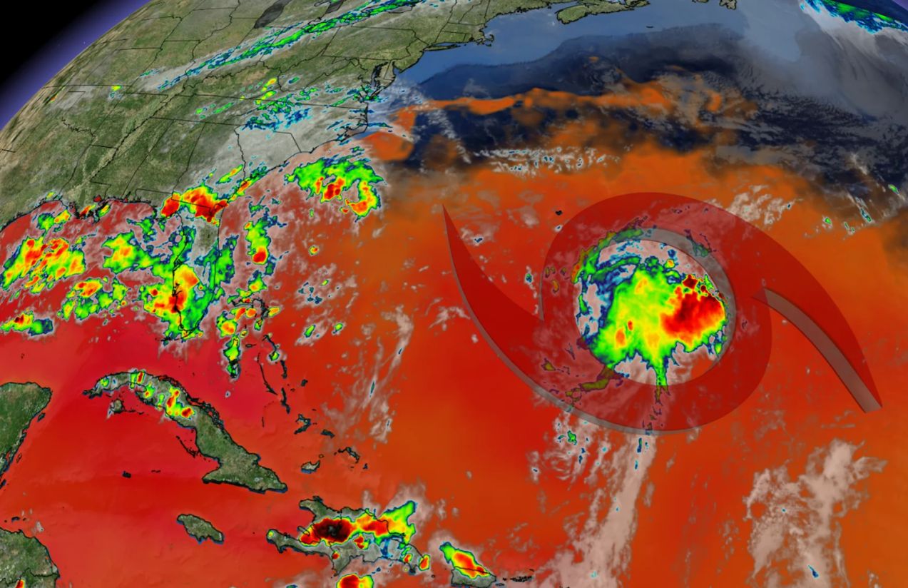
Tropical Storm Fernand emerged this Saturday in the Atlantic Ocean, far southeast of Bermuda. The system formed approximately 300–400 miles (around 520 kilometers) from the islands, with sustained winds near 40 mph (65 km/h). Moving north-northeast at about 15–16 mph (24 km/h), the storm currently poses no threat to land, and no alerts have been issued.
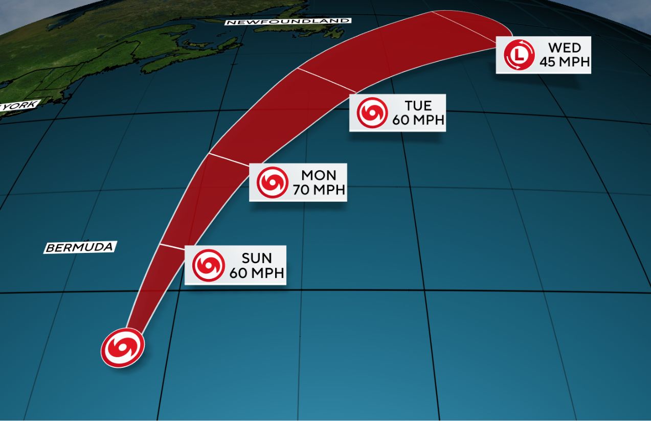
Forecast models suggest that Fernand will continue traveling over warm waters and could strengthen in the coming days, with the possibility of reaching hurricane status by Monday. However, its trajectory indicates it will remain well east of Bermuda, avoiding any direct impact on coastal communities. By midweek, cooler waters and stronger wind shear are expected to gradually weaken the system until it dissipates.

This marks the sixth named storm of the 2025 Atlantic hurricane season, reinforcing expectations that this period would bring heightened activity. While Fernand is not a direct danger to land, its presence is a reminder of how quickly tropical systems can form and the importance of maintaining preparedness throughout the peak months of the season.
What does Fernand mean for coastal areas?
For now, Fernand is not a threat. Its path over open waters means residents along the Atlantic can remain calm, though continued monitoring remains essential.


